Purpose
The updated MS4 permit has several mapping requirements which generally involve mapping stormwater infrastructure under the IDDE control measure and estimating, tracking and disconnecting Directly Connected Impervious Area.
Quick Find:
Relevant Terms
Directly Connected Impervious Area (DCIA): impervious area which drains stormwater runoff into catch basins or directly into waterbodies. Impervious areas that discharge to an area or system that retains the appropriate Water Quality Volume are not considered DCIA.
Outfall: is the point where the MS4 discharges to waters of the state. It's defined as a point source in the permit - 'any discernible, confined and discrete conveyance, including but not limited to, any pipe, ditch, channel, tunnel, conduit, well, discrete fissure, container, rolling stock, concentrated animal feeding operation, landfill leachate collection system, vessel or other floating craft from which pollutants are or may be discharged'.
Resources
Stormwater Infrastructure Mapping
The Connecticut Department of Transportation (DOT) worked with the Standards Committee of the CT GIS Network to develop a standard stormwater infrastructure mapping schema (i.e. the way the data is organized). CT DOT will be using this format for their infrastructure mapping. Towns may find it useful to use or modify this format for their own stormwater system mapping. It may save time in developing your own system and make it easier to exchange stormwater mapping information with CT DOT and other towns and institutions.
The new schema can be downloaded as either a spreadsheet or geodatabase.
Tools for Mapping your Stormwater System
We're testing two different field data collection applications that can be used to map stormwater infrastructure. There will be a Stormwater infrastructure mapping workshop offered to towns this September (2018) and we'll provide presentations on both options there. In the meantime, this comparison chart highlights the key capabilities and requirements of each application.
| Epicollect | Collector for ArcGIS | |
|---|---|---|
| What is it? | Form-based application (no visual aid or map) | Map-based application with ability to cache base maps and imagery |
| Compatible operating systems | IOS, Android | IOS, Android, Windows |
| Required software | open source | ArcGIS Desktop + ArcGIS Online organization (subscription) |
| Data format | CSV | File geodatabase and map service |
| Cost | Free | Variable (depends on type of organization, population size, etc.) |
| Ability to collect pictures? | Yes | Yes |
| Ability to collect point data (ex. outfalls, manholes, catch basins, etc) | Yes | Yes |
| Ability to collect line data? (ex. pipes) | No | Yes |
| Ability to collect polygon data (ex. bioretention areas) | No | Yes |
| Allows for multiple users / editors | Yes | Yes |
| Offline data collection | Yes | Yes |
| Requires data plan | No | No |
| Requires phone or tablet to have integrated or external GPS | Yes | Yes |
| Requires GIS expertise to deploy | No | Yes |
| Expertise required for field data collection | Minimal | Minimal |
What is DCIA?
What is DCIA?
Directly Connected Impervious Area (DCIA) is the impervious area that transports stormwater directly into a waterbody or into stormwater drainage infrastructure that transports runoff directly into waterbodies. Because there is wide scientific agreement that increasing amounts of impervious cover in a watershed lead to degraded water quality, the new permit addresses DCIA in a few different ways. It requires towns to:
- Estimate the amount of DCIA for each outfall to a water body;
- Estimate a town wide DCIA baseline number;
- Track additions and subtractions of DCIA; and
- Implement a Retrofit program to reduce DCIA by 2% by the end of the permit term.
Is your impervious cover connected?
Watch this brief video to get a better understanding of the difference between impervious area and Directly Connected Impervious Area.
Impervious cover data for CT
Through a grant from CT DEEP, NEMO acquired statewide high resolution (1ft) impervious cover data in September 2017. This data includes the percent impervious cover for each town and each basin. The data is based on 2012 imagery to reflect the permit's 5 year look back period for tracking disconnections of impervious cover. You can see this data on the MS4 Map viewer or download it from CT ECO. Towns that have planimetric data or higher resolution impervious data would likely choose to use that data instead.
Calculate DCIA
Calculate DCIA
There are three methods you could use to estimate the DCIA in each basin* in your town. In increasing level of accuracy and effort, they are:
1. Assume Impervious Cover (IC) is 100% connected and is equal to DCIA. If you choose this method you'll likely overestimate the amount of DCIA but the advantage is this information is already available in the MS4 map viewer (use the 'IC by basin' layer).
2. Use the following equations to estimate DCIA based on the land use in each basin. First, categorize each basin into one of the five categories (1 – 5) in the table below then insert the IC value for each basin into the relevant equation to estimate DCIA.
No one knows your town better than you, so categorizing your basins may be an easy exercise to complete by looking at the high resolution aerial imagery and IC in each basin using the MS4 map viewer or your own maps.
NOTE: %IC = percent impervious cover
| Connectivity Level | Description of Contributing Area | Land use type | Equation | Example for a watershed with 20% impervious cover (IC) |
|---|---|---|---|---|
| 1. Fully Connected (default) | 100% storm sewered with all IC | High density mixed use, commercial | None. DCIA% = IC% | 20% DCIA |
| 2. Wicked Connected | Mostly storm sewered with curb and gutter, residential rooftops connected to MS4 | High density residential, commercial, industrial, institutional | DCIA%=0.4(%IC)^1.2 | 0.4(20)^1.2 = 14.6% DCIA |
| 3. Moderately Connection | Mostly storm sewered with curb and gutter, residential rooftops NOT connected to MS4 | Medium density residential, commercial, industrial, institutional, open land | DCIA%=0.1(%IC)^1.5 | 0.1(20)^1.5 = 8.9% DCIA |
| 4. Sorta Connected | 50% storm sewered with some infiltration and residential rooftops not connected to MS4 | Low density residential, open land | DCIA%=0.04(%IC)^1.7 | 0.04(20)^1.7 = 6.5% DCIA |
| 5. Slightly Connected | Small % of urban area storm sewered or mostly infiltration | Agricultural, forested, natural areas | DCIA%=0.01(%IC)^2 | 0.01(20)^2 = 4% DCIA |
This table was adapted by CT DEEP from EPA guidance on DCIA.
3. Calculate DCIA through map analysis and field checking. This requires the most effort but will result in the most accurate DCIA determination. See our Map Analysis and Field Checking page for more detail on this method.
Map Analysis
You can get a good sense of where stormwater drains are using publicly available data on the CT ECO website. Details on conducting a stormwater drainage map analysis using this data can be found here.
Field Checking
In some areas, rural roadways for example, a ‘windshield survey’ from the car will be enough to confirm the status of IC. In more urban areas prepare for sticking your head down a lot of storm drains! As you walk the watershed, note the drains and confirm, when possible, where they take the water—by looking. Where there are no drains, note which way the land slopes and where the stormwater goes—this can best be confirmed by going out on a rainy day. More information on this can be found here.
*Basins as catchment areas
The permit requires that the town or institution calculate the DCIA that contributes stormwater runoff to each of its MS4 outfalls (i.e. catchment area). The question then becomes how to determine the 'catchment area' which is defined as "the land area from which stormwater runoff is collected by a permittee's MS4 and discharges through a single outfall to surface water".
There are methods for identifying the catchment area for an outfall. However, these methods can be cumbersome, time consuming, and often inaccurate. In recognition of this, DEEP has agreed that towns and institutions can use the smallest watershed 'basin' unit that an outfall is in as the catchment area. NEMO's MS4 Map viewer includes this basin layer. If you prefer determining the specific catchment area for each outfall, this method developed by a regional planning agency in Massachusetts may help. Just be warned that in our testing of this method, it was time consuming, did not return great results and required significant field verification.
DCIA Tutorial
For more information on DCIA, this tutorial covers the DCIA-related permit requirements and how to determine DCIA.
Task list
Where the deadline for new MS4 permittees differs from the deadline for existing permittees, the second deadline in parenthesis applies to new permittees.
| Activity | Deadline | Permit Page |
|---|---|---|
| DCIA tasks | ||
| Track DCIA | Jul 1 2017 | 26 |
| Determine townwide DCIA baseline | Jul 1 2020 | 30 |
| Develop retrofit plan | Jul 1 2020 | 32 |
| Begin implementing projects from retrofit plan | Jul 1 2020 | 33 |
| Goal to disconnect 2% of baseline DCIA | Jul 1 2022 | 33 |
| Stormwater system mapping | ||
| Map all MS4 outfalls | Jul 1 2019 (Jul 1 2020) | 23 & Appendix B p.2 |
| Complete detailed stormwater system mapping | Jul 1 2020 (Jul 1 2022) | Appendix B p.3 |
CT MS4 Mapping Workshop Materials
The NEMO program presented a workshop on the Mapping portions of the MS4 Permit on 10/19/18 at Rocky Hill Town Hall. All of the presentations were recorded. The presentation slides and recordings can be found below.
MS4 Mapping Overview
October 19th, 2018
Presented by: David Dickson, UConn CLEAR
An overview of the mapping requirements in the CT MS4 stormwater permit.
Mapping Impervious Cover
October 19th, 2018
Presented by: Chet Arnold, UConn CLEAR
The importance of measuring impervious cover and disconnecting it.
Estimating Directly Connected Impervious Area and Identifying Priority Areas
October 19th, 2018
Presented by: David Dickson, UConn CLEAR
How to estimate directly connected impervious cover.
Identifying Opportunities for Disconnects
October 19th, 2018
Presented by: Chet Arnold, UConn CLEAR
Developing a strategy for disconnecting 1% of impervious cover per year.
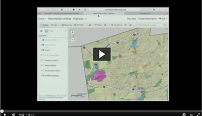
City of Manchester Stormwater Infrastructure Mapping
October 19th, 2018
Presented by: Rich Gallacher and Elizabeth DaRos, City of Manchester
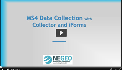
Mapping Stormwater Infrastructure with Collector and iForms
October 19th, 2018
Presented by: Kristen LaBrie, New England Geosystems
How to use Collector and iForms to collect stormwater system data in the field.

City of Stamford Stormwater Infrastructure Mapping
October 19th, 2018
Presented by: Tyler Theder, City of Stamford
Stamford's efforts to map its stormwater infrastructure.

DIY System Mapping on the Cheap
October 19th, 2018
Presented by: Cary Chadwick, UConn CLEAR
Low cost methods for stormwater system field data collection.
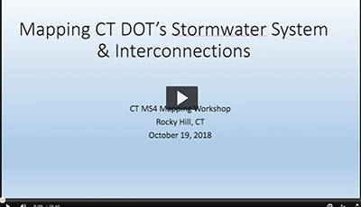
Mapping CT DOT’s Stormwater System and Interconnections
October 19th, 2018
Presented by: Jeremy Willcox and Kevin Carifa, CT DOT
The Agency's plans to map its stormater infrastructure.