MS4 Program Basics
Why is this permit needed?
Stormwater runoff is a major source of flooding, erosion and the pollution of Connecticut’s waterways, and is certain to become even more of a problem as climate change progresses. Accordingly, the Connecticut Department of Energy and Environmental Protection (CT DEEP) has recently revised and expanded the principal permit used to regulate stormwater in the state: the “General Permit for the Discharge of Stormwater from Small Municipal Separate Storm Sewer Systems,” or MS4.
What towns and institutions are included in the MS4 permit?
121 of Connecticut's 169 towns are included in the MS4 General Stormwater Permit.Click here for a map of the towns. Each of these towns have or are part of an "urbanized area," which is a designation of the U.S. Census that takes into account population, population density, impervious cover, proximity to urban areas, and other factors.
State and federal institutions that operate their own stormwater system are now also included in the MS4 permit. This includes university campuses, like UConn, state prisons, military bases, hospitals, public housing authorities, office complexes, etc. that have more than one building and an average daily population of 1,000 or more people.
Are privately-owned and managed stormwater systems covered by any requirements in the MS4 permit?
Legal authorities put in place by towns to be in compliance with the MS4 requirements do allow for inspections, inventories, and maintenance for privately-owned and managed stormwater systems.
Is there funding available to help MS4s comply with the new permit requirements?
As of July 1st, 2021, Connecticut municipalities can now implement their own stormwater utilities. These utilities function the same as other utilities, such as water or sewage, charging a fee on impervious cover in order to generate sustainable funding for stormwater management. Just as residents pay a fee for how much water they use, which in return funds the drinking water services within their area, stormwater utilities charge residents and property owners on the amount of impervious cover on their property. The fee is not based on property tax, but on impervious cover, allowing all properties, even tax-exempt properties, to contribute to the stormwater fund.
For more information, check out our Stormwater Utilities page and out Stormwater Utility and MS4 Compliance Fact Sheet.
Some communities have formed collaboratives to share the responsibilities and costs of equipment, monitoring, public education, etc. Connecticut's first, the Eastern CT Stormwater Collaborative, was formed in 2018. Another example is the Central Massachusetts Stormwater Coalition. It is a good idea to check with your regional Council of Government (COG) to see if they are coordinating any efforts to pool resources.
How do I sign up for the MS4 listserv?
To join the listserv, go to http://s.uconn.edu/ctms4list and click on "subscribe" on the right hand side.
Is the CT Deptartment of Transportation included?
A final version of CT DOT's MS4 General Permit was released in May 2018 and is posted on DEEP's stormwater page. The DOT permit went into effect July 1, 2019.
CT DOT presented a webinar on their MS4 permit which is posted on the UConn CLEAR website webinar library. And a side note: CT DOT created an email address that municipalities can use to ask questions about the CT DOT permit, it's DOT.MS4@ct.gov.
General MS4 Questions
What are Priority Areas?
The MS4 permit generally applies town (or institution) wide but certain requirements focus on what are deemed "priority areas". These include areas that meet any of the following three conditions: in the Census Urbanized Area, catchments with more than 11% DCIA, or catchments that discharge to stormwater impaired waters.
Below is a screen shot from the MS4 map viewer looking at Naugatuck with the Urbanized area (gray) layer, the IC by Basin (yellow) layer, and the 2016 stormwater impaired waterbodies (red) layer(s) turned on. We can get a general sense that Naugatuck's priority area includes most of the town except the light gray area to the west. Notice that there are a few yellow basins that go beyond the dark gray urbanized area. Because the yellow basins are areas with more than 11% impervious area - not necessarily Directly Connected Impervious Area - they may be less than 11% DCIA and thus not a part of the prioirity area. Naugatuck could use one of our approaches to estimate DCIA in those basins to determine their %DCIA.

We also made a short video explaining priority areas here:
What is considered a surface water for purposes of the permit?
“Surface Water” means the waters of Long Island Sound, its harbors, embayments, tidal wetlands and creeks; rivers and streams, brooks, waterways, lakes, ponds, marshes, swamps, bogs, federal jurisdictional wetlands, and other natural or artificial, public or private, vernal or intermittent bodies of water. Surface water does not include ground water.
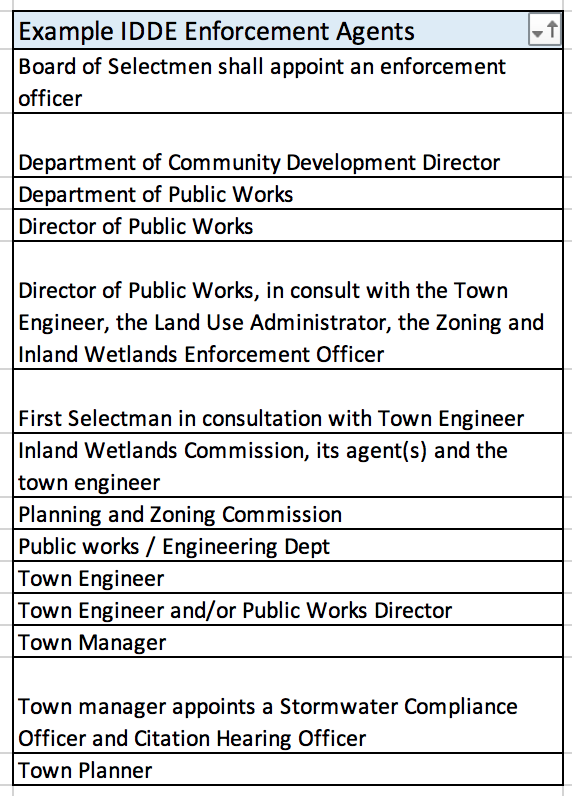
Who is usually responsible for enforcing the IDDE ordinance?
There doesn't seem to be one typical person in town who fills this role. The list below gives a sense of the variety of positions many CT towns have designated as their ordinance enforcement agent. Most ordinances also say that the authorized enforcement agent may identify a designee in writing.
When is the stormwater fee-in-lieu requirement due?
There was confusion about whether the 'fee in lieu of' and off-site mitigation requirements on page 28 of the permit were to be implemented by 2019 but good news! The deadline is July 2021 for existing (and July 2022 for new permittees) - which aligns with the deadline to establish the corresponding legal authority. We are planning to develop guidance to help out with this aspect of the permit.
What options do we have for reusing materials from catch basin clean-outs and street sweeping?
Unfortunately, there aren’t a lot of great options. In the past, it was sometimes used for landfill cover material but there aren’t many landfills left to use it on. DEEP has a guidance document with some suggestions.
Annual Reports and the Stormwater Management Plan
When are things due to DEEP?
Each MS4 Town and institution must post their Stormwater Management Plan for public comment by April 1, 2017 (No joke!) and share a link or electronic copy along with a registration form to DEEP by April 3, 2017. The public must be allowed to comment for 60 days.
Annual Reports are due to DEEP every year by April 1st. The first Annual Report is due to DEEP by April 1, 2018 after being made available for public comment for 45 days.
Are templates available?
Yes! NEMO modified a Stormwater Management Plan template developed by the Western Connecticut Council of Governments (WestCOG) for statewide use. It can be found here. NOTE: CT DEEP has not officially sanctioned this template, but it is based on the permit language and DEEP's MCM checklist.
And NEMO created two Annual Report templates: One for New MS4 permittees and one for Existing MS4 permittees. They are available for download under the Implementation section/Annual Reports.
Where should the public send comments on our Stormwater Management Plan and Annual Reports
Public comments on your Stormwater Management Plan or your Annual Report should be sent to the DEEP Commissioner.
By Email: DEEP.StormwaterStaff@ct.gov
OR
US Mail: CT DEEPWater Permitting and Enforcement Division
79 Elm Street
Hartford CT 06106
Attn: Karen Allen
What is put in the different dry and wet weather monitoring tables in Part 3 of the annual report?
For more information, be sure to check out the flow charts in the Resources section of our Monitoring page.
Section One
Table 1 displays your list of catchments and ranking results. You are also able to use the CT DEEP Basin ID instead of Catchment ID.
Section Two
Table 2.1 displays the sample results from your dry weather IDDE baseline investigation from outfalls and interconnections. These outfalls are located in a priority area and are classified as a high or low priority outfall.
Table 2.2 displays the sample results from your wet weather baseline catchment investigation. It includes all high and low priority catchment outfalls within the priority area which have one or more System Vulnerability Factors (SVFs) present. This section is for identifying whether or not an investigation is necessary.
Section Three
Table 3.1 displays your list of SVFs.
For Section 3, the dry weather screening is conducted for manholes at key junctions, whereas wet weather screening (if required) is at the outfalls.
Table 3.2 displays the sample results from the dry weather screening in manholes at key junctions being investigated for an illicit discharge but do not have any SVFs present. Follow-ups are required within one year and again within five years.
Table 3.3 displays follow-up wet weather monitoring of a catchment outfall with a SVF present, after the illicit discharge has been removed. The follow-ups are required within one year and again within five years.
Table 3.4 displays the data for each illicit discharge source confirmed throughout the catchment investigation procedure.
Mapping
What is DCIA?
DCIA means directly connected impervious area. It is a stormwater geek's term for hard surfaces that contribute stormwater runoff to the storm sewer system. It is also sometimes called effective impervious area. There are a few permit requirements that involve DCIA like determining acres of DCIA town-wide and identifying any basins with DCIA more than 11% which are part of the "priority areas" for purposes of the permit.
Watch a tutorial on all things DCIA in the CT MS4 permit!
How do you calculate DCIA?
UConn CLEAR worked with DEEP to identify a few methods to determine DCIA. The Mapping sectionhas the details.
This DCIA tutorial also goes over ways to determine DCIA (starts around minute 12:45):
What does it mean to disconnect an impervious area?
An impervious area is considered disconnected when the minimum amount of the "Water Quality Volume" is retained on site. For sites with DCIA less than 40% - retain the first 1 inch of rainfall. For sites with more than 40% DCIA – retain the first ½ inch of rainfall.
You can retain stormwater on site in many ways as long as it infiltrates the ground or is reused without a surface or storm sewer discharge. In most cases, disconnection will be achieved through the use of Low Impact Development (LID) practices like rain gardens, bioretention areas, pervious pavements, green roofs, etc. It can also be accomplished by simply directing runoff to a vegetated area such as a lawn rather than into the stormwater system.
Where does the Urbanized Area layer come from?
The urbanized area layer in the MS4 map viewer is derived from the U.S. Census Bureau's Urbanized Area data from the 2010 census - it has been slightly modified for MS4 purposes in CT. We got this layer from DEEP, who got it from EPA Region 1.
Water Quality Monitoring
Is there a list of impaired waters for the purposes of the permit?
Every two years, CT DEEP submits an Integrated Water Quality Report (IWQR) to the U.S. EPA listing all known impairments to the state's waterbodies.
NEMO developed a CT MS4 Map which shows the impaired waters data from the latest IWQR. Now you can see Connecticut's impaired waters on a map and easily find a waterbody's impairment just by clicking on it. The map only shows the impairments related to stormwater since those are the one's that apply under the MS4 permit.
Additional resources:
- DEEP's Town by Town Water Quality Fact Sheets (scroll to the bottom of page and select the pdf covering your town)
- Impaired Waters Table for the Industrial Permit
How do I know which outfalls have to be screened/monitored?
There are two monitoring requirements in CT's MS4 permit. The first deals with monitoring outfalls that discharge directly to stormwater impaired waters. These are the purple and red waterbodies on the MS4 map viewer.
The second monitoring requirement is related to the illicit discharge detection and elimination (IDDE) program.
For more help understanding the permit monitoring requirements, check out the monitoring page.
How can you distinguish between human vs. wildlife sources of bacteria impairement?
DNA testing is available to determine sources of fecal bacteria here. The case studies are older but the technology is widely used today.
Which type of chlorine should towns sample for during the IDDE screening?
The idea of IDDE screening is that all tests (except bacteria) can be done in the field. Sampling for either free chlorine or total chlorine is acceptable. DEEP is looking for detectable levels of chlorine and the test kits or strips should have a lower detection limit of 0.1 mg/l or less.
When does dry and wet weather monitoring need to be conducted for IDDE Baseline and Priority Catchment monitoring?
The IDDE baseline monitoring requires dry weather monitoring for all outfalls and interconnections in priority areas that are categorized as either high or low priority catchments.
The priority catchment investigation monitoring then requires wet weather monitoring of at least one high or low priority catchment outfall that has an SVF present. This is the initial catchment investigation if System Vulnerability Factors (SVFs) are present.
The priority catchment investigation then requires dry weather screening in key junction manholes of catchments being investigated for an illicit discharge, but do not have any SVFs present. Follow-ups to confirm removal of any illicit connections are required within one year and again within five years.
If there are any SVFs present, wet weather monitoring must be continued with follow-ups within one year and again within five years.